The North
The Region
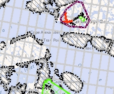
North Circumpolar Region (2017)
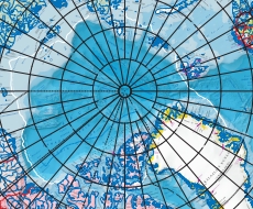
This bilingual map from the Atlas of Canada (Reference Map MCR0001) shows the geography of the northern circumpolar region, north of approximately 55 degrees, at a scale of 1:9 000 000.
Static map
Static map
- North Circumpolar Region (2017) (47,992 KB PDF) (37 inches by 43 inches or 94 centimeters by 110 centimeters)
Northwest Territories – Lands related to Indigenous Groups
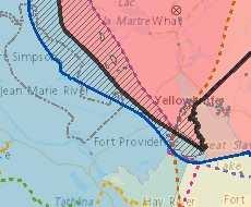
This map is a reference tool intended to help representatives from governments, Indigenous organizations, industry, regulatory bodies, as well as any other interested person, understand Indigenous rights and interests in the Northwest Territories.
Interactive map, static map
Interactive map
Static map
- NWT Lands related to Indigenous groups (9,699 KB PDF) (11 inches by 17 inches or 27.94 centimeters by 43.18 centimeters)
Environment
Northern Oil and Gas Dispositions
The Northern Oil and Gas Disposition maps display all current dispositions of oil and gas rights. Maps are also available for current and former call cycles, including calls for nominations, calls for bids and call results.
Interactive map, static maps
Interactive map
Static maps
- Beaufort Sea (789 KB PDF) (8.5 inches by 11 inches or 21.59 centimeters by 43.18 centimeters)
- Eastern Arctic (1,552 KB PDF) (8.5 inches by 11 inches or 21.59 centimeters by 43.18 centimeters)
- High Arctic (984 KB PDF) (8.5 inches by 11 inches or 21.59 centimeters by 43.18 centimeters)
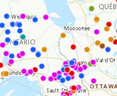
Northwest Territories – Contaminated sites
These maps show the locations of contaminated and remediated sites (including the remediation status) in the Northwest Territories. The Story Maps explore the sites' history and use in greater detail.
Interactive map, story map and static map
Interactive map
Story map
Static map
- Contaminated sites (2,931 KB PDF) (11 inches by 17 inches or 27.94 centimeters by 43.18 centimeters)
Natural Resources
Northwest Territories – Federal Mineral and Land Tenure

This map shows mineral and land tenure on federal or crown lands, as well as oil and gas rights and Indigenous and Inuit owned lands.
Interactive map
Interactive map
Note: It is possible to view Government of the Northwest Territories (GNWT) layers related to land/mineral tenure within the NT GeoViewer. To do so, use the "Add/Remove Layer(s)" button and add the "Available Layers", GNWT Planning Cadastre (for land tenure) and/or GNWT Economy (for mineral tenure).
Nunavut – Map Viewer
This map viewer displays the mineral rights spatial data that is maintained by Crown-Indigenous Relations and Northern Affairs Canada (CIRNAC) as well as several datasets prepared and maintained by other data custodians that are useful to CIRNAC clients.
Interactive map, data
Interactive map
Information on mineral rights is updated as applications are received and processed in the Mining Recorder's Office.
Data
Indigenous mining agreements
Over the last few decades, Aboriginal-industry relationships and partnerships have evolved tremendously through the conclusion of various types of agreements related to mine development that have proven to be successful in securing benefits for many Indigenous communities.
Interactive map, data
Interactive map
This interactive map, developed in partnership with Crown-Indigenous Relations and Northern Affairs Canada, shows where these agreements are taking place across the country and provides specific information on exploration projects and mines, Indigenous communities, and the types of agreements signed between communities and mining companies.
Data
Food and nutrition
Nutrition North Canada
Nutrition North Canada (NNC) is a Government of Canada program that helps make nutritious food and some essential items more affordable and more accessible.